- Size: 21 islands on Superior's Shoreline
- Max Depth: 60' around caves
- Clarity: 15'
Lake Superior is the largest of all the Great Lakes, it has 1,729 miles of shoreline to explore and in my opinion is one of the most scenic and beautiful bodies of water in the Midwest. Lake Superior holds a special place in my heart; I’ve taken trips to this lake every year since as long as I can remember, as I have a cabin up north Wisconsin just 5 miles from Lake Superior.
The Apostle Island National Lakeshore is comprised of a stretch of shoreline and 21 islands at the northern tip of Wisconsin. The sea caves are located at the western end of the Mainland Unit of Apostle Islands National Lakeshore in far northern Bayfield County.
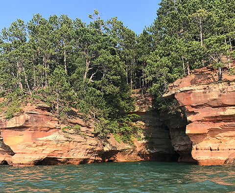

The Apostle Island Sea Caves are about an hour drive east of my cabin, so it was the perfect day trip. I had been planning this trip for a while, so I was excited when the day came. I drove to Bayfield to get lunch. If you ever have a chance to take the ferry to Madeline Island, I do recommend it. Lots of cool places to paddle there, as well.
After lunch, I drove back west about 20 miles to Meyers Beach in Cornucopia, WI. Of all the places I read about, this is one of the most popular places to launch your board/kayak. You will have to carry your board down a flight of stairs to the beach and they do charge you to park your car in the lot. They also have National Park Rangers on site during the summer months to monitor traffic and to deter stand up paddle boarders from going out to the sea caves. The ranger did come up to me and gave a lengthy reason on why I should not take my board out to the sea caves.
They advise that all kayakers use a seaworthy craft of at least 16 feet, with a PFD, a wet or dry suit and a spray skirt. It’s also advisable to have a bilge pump, compass, charts, extra paddle, paddle float, tow line and throw bag, and be able to perform a self or assisted rescue. If you don’t know what any of those things are, you probably should not be kayaking the caves on your own. Of course I smiled, nodded, and took everything with a grain of salt, as I checked The National Weather Service to ensure winds weren’t too bad that day. It is very important to check the weather before going out there as the Northwest winds can cause ocean-like waves and can create very dangerous conditions, especially near the caves.
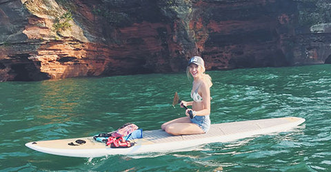
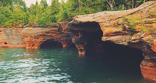
From Meyers beach to the Bayfield Peninsula Sea Caves, which is not in Bayfield itself but Bayfield County, is about a 2 mile paddle. This was the easy part of the paddle; I was actually able to stand. The water was pretty clear, so I could see the bottom.The farther out and closer to the sea caves we got the water started to get rougher. Once we got to the caves I was having a harder time balancing and decided to kneel. The red sandstone cliffs stretch for two more miles, with countless slot canyons, caves, tunnels, archways and other rock formations to paddle in, through, and around. There are also hiking trails along the mainland if you want to scope it out before you hit the water.
I paddled for about another mile along the caves before the Northwest wind picked up and I was hitting smaller white caps. This made paddling more difficult. I knew it would be best to turn around, which made it difficult paddling against the waves, but better safe than sorry. Once I was past the caves and closer to shore I was able to stand back up. If the water was calmer I would have been able to stand up paddle through the caves more. Oh well, it was still so beautiful and well worth the waves. There is always next year! 10/10, would highly recommend!
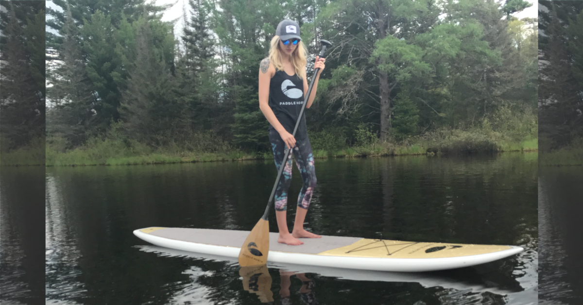
This review is brought to you by Ruthie (@ruthielinnea), a Brand Ambassador for Paddle North.
Stand with us:
Have you paddled this lake? Let us know your thoughts in the comments! Have your own lake to review? Send an email to peter@paddlenorth.com to get it featured on this site.

1 comment
Tom Ernst
If you plan on a paddleboard thing on the Apostle Islands. I would like to learn the dates of it
Leave a comment
All comments are moderated before being published.
This site is protected by hCaptcha and the hCaptcha Privacy Policy and Terms of Service apply.